Cairo bus system map
You can find on this page the Cairo buses map to print and to download in PDF. The Cairo bus system map and the Cairo trolley map present the network, stations and lines of the buses and trolley of Cairo in Egypt.
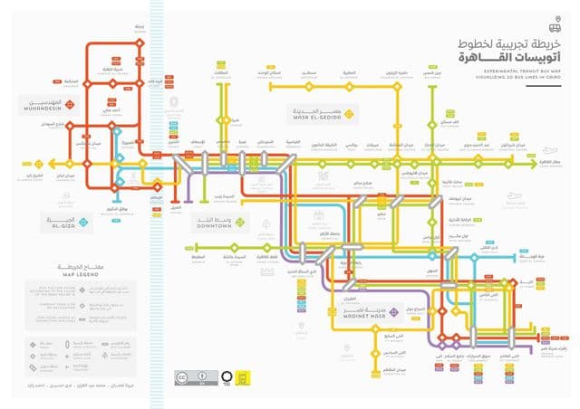
Cairo bus map
The Cairo bus map shows all the stations and lines of the Cairo bus system. This bus map of Cairo will allow you to easily plan your routes in the buses of Cairo in Egypt. The Cairo bus system map is downloadable in PDF, printable and free.
There is a public bus system that offers several lines of service in different classes and prices as its shown in Cairo bus map. There is the standard bus service, the air-conditioned service, known as CTA short for Cairo Transport Authority (for a higher price) and Mini-buses (smaller buses and more extensive network). Other transport services includes the traditional Cairo Taxi and Micro-buses, both are privately run by individuals. The Micro-buses are the cheapest form of transport in Cairo, yet not very reliable. The traditional Cairo Taxi is also run by individuals and usually operate on older models of cars that are being replaced by the effective Cairo Cab for a more modern look in the city. Egyptians use cabs, cars, and the Nile ferry as methods of transportation.